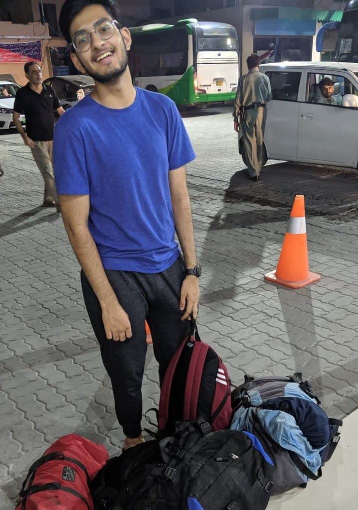
The summer I was leaving Pakistan, I stood on the edge of a new life, bags packed for Europe, but my heart was still anchored in Pakistan. Not in the chaotic buzz of Lahore where I grew up, but in the rugged, untouched mountains up North—my true home. I wasn’t just leaving my country; I was leaving behind memories, laughter, and most painfully, my little brother. So, I did what any over-emotional big sister would do—I kidnapped him for one last adventure, a my dramatic farewell to the mountains. It was his first time traveling to Northern Pakistan (shame, I know), and I feel bad for setting the bar so damn high. Four years have passed, but no trip has ever come close to that one.
This blog lays out our journey through some of Pakistan’s most incredible landscapes. From the enchanting Deosai National Park to the hidden gem of Minimarg, and finally, to the footsteps of the mighty Nanga Parbat, the second highest mountain in Pakistan towering at 8126m.
A Little Bit About Pakistan
Sure, Pakistan makes headlines for all the wrong reasons—terrorism, political chaos, and Osama bin Laden. But for me, it’s always been about the mountains. Pakistan hosts five of the fourteen either-thousander peaks in the world. Towering giants that make you feel insignificant yet incredibly alive. The kind of places where the Wi-Fi is non-existent, but the stars put on a show every night. My heart belongs to these rugged landscapes, the five eight-thousanders that pierce the sky, and the glacial lakes that reflect them. I wanted my brother to see this side of Pakistan—not the one on TV, but the one that steals your breath and leaves you humbled.
Northern Pakistan Itinerary
Here’s the route we took:
Getting to Deosai National Park
Deosai National Park is sprawled across the Skardu and Astore districts of Gilgit-Baltistan, a remote expanse that feels like the edge of the world. The closest major cities are Skardu and Gilgit, both acting as gateways to the park. If you have extra days, here are some incredible things to do in Skardu before heading to Deosai. If you’re feeling fancy (or short on time), you can fly into either city from Islamabad. But here’s the kicker: flights to Skardu and Gilgit are notoriously unreliable. Cancelations are more of a rule than an exception, and I’ve learned that the hard way—multiple times. That’s why we chose the road route. Less convenient, but a hell of a lot more reliable.
If you’re worried about safety and logistics while traveling in Pakistan, you might want to read up on what to expect before planning your trip.
The first leg of our journey was on bus from Lahore to Rawalpindi. We left Lahore, long before the sun even considered making an appearance. There’s something surreal about leaving a city that never really sleeps while the rest of the world is still in bed. We hopped on a Daewoo bus — usually quite punctual but this one broke down on the motorway half way between Lahore and Islamabad, and we had to wait roadside for a second bus from Lahore to come pick us up. This second bus had seen better days.
But then, as Lahore’s concrete sprawl gave way to the green hills of the Potohar Plateau, excitement kicked in.
From Rawalpindi, the journey gets trickier. Renting a car sounds simple enough, but here’s the catch: Self-drive rentals don’t exist in Pakistan. You’re hiring the driver too, like it or not. It’s a package deal. But honestly? It’s worth it. Navigating the hairpin bends and pothole-riddled roads of the North is not an easy feat.
There’s this moment when the air changes, the dust settles, and the first outline of the Himalayan foothills appears on the horizon. I’ve done this route a dozen times, but my brother? His eyes were glued to the window, wide with awe. Seeing the mountains for the first time is something you never forget, and watching him fall under their spell was worth every cramped minute on that bus.
We made a pitstop in Naran, mainly to stretch our legs and eat something that wasn’t packaged in plastic. If you’re doing this route, Naran is your last taste of semi-civilization before heading into the wild. Also, a little travel tip: stock up on snacks and toiletries here. The further North you go, the fewer your options.
From Naran, we ascended towards the Babusar Pass, sitting at a staggering 4,173 meters above sea level. The road twists and turns, each bend revealing a view that’s more breathtaking than the last. At the top, the air is thin, cold, and pure—almost biting. And no trip to Babusar is complete without stopping for pakoras and chai. It’s practically a rite of passage.
Eighteen hours on the road, and we finally made it to Astore. If you’ve read my previous posts, you’ll know I don’t exactly have the fondest memories of this place. True to form, Astore didn’t disappoint. Our car broke down just before entering the town. There’s something poetic about consistency, even when it’s consistently bad luck.Cue the hitchhiking adventure. We flagged down a passing jeep—nothing bonds strangers faster than mutual suffering on a mountain road. They dropped us off at Chillam, the last checkpost before entering Deosai. By this point, my brother’s face was a cocktail of exhaustion, annoyance, and a hint of “Why did I agree to this?” Not exactly the confidence-inspiring start I was hoping for.

First Impressions of Deosai Plains – The Land of Giants
The Deosai Plains are the second-highest altitude plateau in the world. The name itself is a combination of two words in the local Balti language: ‘Deo’ (giant) and ‘Sai’ (shadow). It was named so because, for a long time, people believed the place was haunted by giants. And when you visit, you understand why. Vast, treeless plains stretch endlessly in all directions, with a silence that feels heavy and almost unnatural, broken only by the sound of the wind or the occasional whistle of a marmot in the distance.
There are a few designated camping grounds, the most popular ones being Sheosar Lake and Bara Pani, which literally translates to ‘big water.’ While you can technically camp in other areas, I wouldn’t recommend it. It’s smarter to stick around other campers because I didn’t the last time I visited Deosai and had a close encounter with a brown bear. Lesson learned—stick to the group, no matter how adventurous you think you are.
We chose Sheosar Lake. On a clear day, you can catch a glimpse of Nanga Parbat towering in the distance. We set up our tent—by “we,” I mean me—and spent the rest of the day lazing in the meadows, watching birds, swimming in the icy waters of Sheosar Lake, eating pakoras, and drinking chai.
I’m a hardcore morning person, so it might surprise people when I say this: Deosai at night is even more magical. The sky is ablaze with thousands of shooting stars, crisscrossing in every direction. The silence in the plains and the warmth of the campfire was all it took for me to forget about the car shitshow in Astore. It was just us, the stars, and the endless plains stretching out in every direction.
More About Deosai National Park
Altitude | Deosai National Park is located at an altitude ranging from 3,500 meters to 5,200 meters above sea level.
Size | The park covers an expansive area of approximately 3,000 square kilometers.
When To Go | The best time to visit Deosai National Park is during the summer months, from late June to early September.
Days required | A typical visit can range from 2 to 4 days, depending on your interests and activities.
Accommodation | Accommodation options within the park are limited. Camping is a popular option.
Wifi/signal availability | Deosai National Park is remote and lacks consistent mobile network coverage

Onward to Minimarg
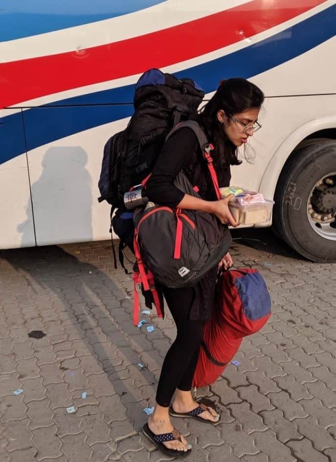
After two blissful nights at Deosai, we packed up and set off for Minimarg, hoping to rest for a couple of days before the trek ahead. The journey from Deosai to Minimarg is about 100 kilometers, but it feels like crossing into a different world. As we left the high-altitude plains behind, the landscape shifted from vast, treeless plateaus to lush green valleys. It was beautiful—but, of course, nothing is ever that simple. Enter the next shitshow.
Shitshow 1: It was monsoon season, and the locals warned us we might not even make it to Minimarg. Landslides were a real possibility, and the roads were as unpredictable as the weather. It’s never comforting to hear, “You might get stranded for days,” but we were too stubborn (or too stupid) to turn back.
Shitshow 2: Even if we did make it, we didn’t have a confirmed booking at the army mess in Minimarg. It was one of those “maybe it’s available, maybe it’s not” situations. Our dates had changed, and I was getting radio silence from my contact. But this was potentially my last shot to see Minimarg before moving to Europe, so I decided to take my chances. Worst case scenario? We’d be homeless at 9,000 feet.
To get to Minimarg from Astore, you have to cross Burzil Pass, one of the highest mountain passes in the region, sitting at 4,100 meters. This isn’t just any pass; it used to be an ancient caravan route connecting Gilgit to Kashmir before the independence of Pakistan. The area across the pass remains cut off from the rest of the world for seven to eight months each year due to heavy snowfall. It only becomes accessible from June to September, and even then, the journey is not for the faint-hearted.
We began our ascent, navigating narrow, winding roads that seemed to cling to the mountainside by sheer willpower. The higher we climbed, the more the temperature dropped, and the wind howled through the valleys. The road itself was a series of hairpin bends, barely wide enough for one vehicle. Looking down wasn’t an option unless you wanted to induce a panic attack. The landscape was rugged and unforgiving, and every kilometer felt like borrowed time.
Despite the nerves and uncertainties, there was something undeniably thrilling about this part of the journey. It felt like we were heading into the unknown, with no guarantees and no turning back.
More About Minimarg
Altitude | Minimarg is located at an altitude of approximately 2,844 meters (9,331 feet) above sea level in Pakistan.
Size | Minimarg is a small village and the surrounding area is relatively compact, with a limited population and infrastructure.
When to go | Summer months, from late May to early September.
Days required: At least 2-3 days to explore the village and its surroundings.
Permits: Travelers require a permit to visit Minimarg, especially if they plan to venture further into the restricted border areas. Foreigners are not allowed to cross the chekpost into Minimarg due to security reasons.
Accommodation | Needs to be prebooked at the army mess and there is very limited availability. The accommodation itself is as luxurious as it can get in the remote areas of Pakistan.
Wifi/signal availability | Minimarg and its surrounding areas may have limited or no access to wifi, and mobile phone signal coverage can be erratic. Travelers should be prepared for a lack of connectivity and plan accordingly.
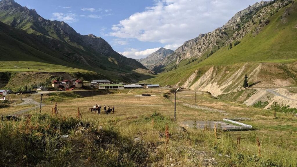
Finally Reaching Minimarg
Back to Shitshow 2—Minimarg Valley is the hardest place I’ve ever tried to get to in Pakistan. Its proximity to the Indian border and military occupation make it a restricted area, off-limits to most civilians. After three years of calling in favors and navigating endless red tape, I finally secured us a room at the army mess in Minimarg.
Of course, nothing goes smoothly. Our dates changed, and the booking was still unconfirmed. It was one of those trips where nothing felt certain, but I was determined to see it through. Luck was finally on our side. We made it through Burzil Pass without getting stranded, and despite the bureaucratic nightmares, our stay in Minimarg turned out to be one of the most memorable parts of the trip. It was like the mountains knew I had to say goodbye.
As you cross into the valley, the disparity between the villages before the army control and Minimarg itself is staggering. You leave behind extreme poverty and enter a place with cafes, polo grounds, and well-maintained roads—luxuries that are virtually unheard of in other parts of Gilgit-Baltistan. It felt like a world within a world, reserved for those with the right connections.
Our first stop was Domail, surrounded by lush green meadows and towering pine trees. Domail is home to two famous lakes: Rainbow Lake, which changes color depending on the sunlight, and Crystal Lake, with water so clear you can see straight to the bottom. Both lakes are an easy walk from the main village and worth every step.
Minimarg to Nanga Parbat
After recovering from our journey and enjoying the unexpected luxury of room service in Minimarg, we geared up for the most exciting and physically strenuous leg of our trip. We were about to hike to the Rupal Face, the south side of Nanga Parbat, famously known as the Killer Mountain. This was the closest you could get to this giant without climbing gear, and I couldn’t think of a better way to end this journey.
Trekking to the Southside of Nanga Parbat
Nanga Parbat, the second highest mountain in Pakistan, stands as one of the most awe-inspiring peaks in the world. Hidden away in the Himalayan range, the trek to its base camp through the Rupal Valley is nothing short of magical. I’ve done a fair share of treks across Pakistan, but this one easily made it to the top of my list.
We started from Astore and made our way to Tarashing, our first campsite. Two friends joined me on this leg of the journey, and one of them came armed with homemade kebabs and minced meat. We spent the evening grilling over a bonfire, eating under a canopy of stars, and exchanging stories. It was the kind of night you remember for a long time.

The next morning, we began the hike from Tarashing to Herligkoffer Base Camp (3550m). With every step, the views became more dramatic, the peak of Nanga Parbat revealing itself a little more. An easy way to know how much I love a hike is that the best ones make me cry—in a good way. I cry easily, okay? But this was different. I wasn’t sure if it was the overwhelming beauty or the realization that this was probably my last time seeing these mountains for a long while. Whatever it was, the tears flowed.
From Herligkoffer to Latboah, the trail became more challenging. The altitude gain was noticeable, and the rocky terrain demanded focus. But every time I looked up, the towering peak of Nanga Parbat loomed closer, so massive it felt like it could swallow the sky. It was humbling. I’ve stood before many mountains, but this one has an energy that demands respect.
Read my full guide on trekking the souths side basecamp of Nanga Parbat here.
More About Nanga Parbat base camp
Trek Days | We did the trek in 3 days but it’s advisable to split it over 4 days.
Trek Distance | The trek is a total distance of 26km.
Altitude | The trek starts at an altitude of around 2900m and goes up to 3530m
When To Go | Summer months from May to August, avoid the monsoon season in July.
Guide | It is highly recommended to hire a local trekking guide or join an organized trekking group for the trek. Guides are familiar with the terrain and can provide valuable safety and navigation assistance.
Accommodation | All days are camping in tents. If you prefer more facilities it’s better to go on the Raikot or Fairy Meadows side.
WiFi/Signal availability | Internet and mobile signal availability can be limited or nonexistent along most parts of the trek.

If you’re looking for more off-the-beaten-path treks to do in the Gilgit-Baltistan region, Khaltaro Valley and Khun meadows are worth exploring!
Saying Goodbye to the Mountains
The next day was our last in the mountains. We made our way back to Tarashing and began the long journey back to Lahore. The ten days I spent in the North were exactly what I needed. It was the sibling bonding experience I’d hoped for, and one of the best trips I’ve ever taken in Pakistan. A week later, Sym flew to Canada, and I left for Hungary.
It’s been four years since that trip, and I haven’t gotten another chance to travel alone with my brother. Last month, he flew out to meet me in Berlin, and we went on another adventure across Europe. Stay tuned to find out how that one ranks! 😊
Till then, if you’re planning a trip to my country, read my guide to travelling in Northern Pakistan.