A practical guide to the most rewarding day hike in Aconcagua Provincial Park.
Mount Aconcagua dominates the skyline in this part of the Andes — and the Confluencia Base Camp hike is the easiest way to experience it without needing mountaineering skills or gear.
The trail is a well-marked, high-altitude out-and-back route that takes you into the heart of Argentina’s most famous national park. It’s just under 15 kilometers round-trip, but delivers real altitude, dramatic scenery, and a sense of scale that’s hard to come by on a day hike.
Coming from South Asia, I’ve seen my share of serious peaks. But what sets Aconcagua apart isn’t just its height — it’s the way it rises so unapologetically from everything around it. After Everest, it has the highest prominence of any mountain on Earth. You feel it in your chest the minute it comes into view.
The hike winds through the wide, barren Horcones Valley, crosses a glacier-fed river, and ends at the first base camp used by climbers heading for the summit. It’s a rare chance to walk part of a world-class route — without the frostbite.
Here’s exactly how to plan it.
Confluencia Hike Snapshot
Distance: 14.5 km (9 miles) out and back
Duration: 4–6 hours
Difficulty: Moderate (due to altitude, not terrain)
Starting Elevation: 2,950 m (9,678 ft)
Ending Elevation: 3,400 m (11,155 ft)
Elevation Gain: 450–500 m (approx. 1,500 ft)
Trail Type: Wide dirt path, well-marked
Season: November to April (park closed outside this window)
Entry Time Window: 8:00–11:00 AM only
Permit Required: Yes (more details below)
What is Confluencia Base Camp?
Confluencia is the first major base camp on the normal route up Mount Aconcagua — the highest mountain in South America and the second highest of the Seven Summits. While most people who reach it are climbers on multi-day expeditions, the camp is also the endpoint for a popular day hike that’s open to anyone with decent fitness and a park permit.
Sitting at 3,400 meters above sea level, Confluencia offers a taste of high-altitude trekking without the risk or commitment of an alpine expedition. The trail up is well-marked and non-technical, but the elevation still gives it enough edge to feel like an achievement. In terms of effort vs. reward, this one’s hard to beat.
The camp itself is a cluster of bright yellow expedition tents, a ranger station, and a medical post — more functional than scenic. But the real payoff is everything that surrounds it: snow-dusted ridges, sculpted peaks, and the sheer scale of the Andes on full display. You’re not at the top, but you’re deep enough in to understand why people try.
How to Get There
Self-Drive (Recommended)
We stayed in Uspallata the night before the hike — partly because we had friends driving in from Chile, but mostly because it let us get an early start. If there’s one hiking tip I swear by, it’s this: start early if you want the trail to yourself. Solitude in the mountains doesn’t come free — you have to beat the vans.
From Uspallata, it’s about 90 minutes on Route 7 to reach the park. It’s a scenic, straightforward drive, with wide desert valleys giving way to rugged ridgelines as you head toward the border. We passed Puente del Inca, a natural rock bridge streaked with mineral color — worth a quick pull-off if you’ve got time.
If you’re coming from Santiago, Chile, the drive takes around five hours, also along Route 7. The entrance to Aconcagua Provincial Park is located about 15 kilometers east of the Argentina–Chile border. It’s absolutely doable as a day trip if you start early and don’t mind a long day on the road.
We reached the park gate just after 8 AM, when it opens. The ranger at check-in looked like he’d just rolled out of bed — and we might’ve been the first hikers of the day. The entrance is simple but clearly marked. You’ll see a small building on the left with a ranger post and bathrooms. This is where you show your permit receipt and passport. After that, you’re good to go.
You can park just inside the gate — there’s a designated lot about 1 kilometer from the trailhead. The road is well-maintained and easy to follow. From the parking lot, you’ll start the hike into Horcones Valley with Aconcagua already looming in the distance.
Public Transport from Mendoza
If you don’t have a car, it’s still possible to reach the trail using public transport — but you’ll need to plan carefully. Three buses per day run from Mendoza’s Terminal de Ómnibus to the Horcones entrance of Aconcagua Park. The trip takes about 4 hours each way. Ask for a bus heading toward Las Cuevas or Uspallata and confirm it stops at Horcones.
Buses are operated by companies like Andesmar and Nevado, and tickets can be bought at the terminal or online in advance.
Guided Day ToursSeveral companies run guided hikes to Confluencia departing from Mendoza. These typically include round-trip transport, permits, and a guide. Some even throw in snacks or lunch. This is a good option if you don’t want to deal with logistics or want to learn more about the region’s geology and history as you walk. You’ll likely be with a small group.

Permits + Entry Process
You’ll need a day trekking permit from Aconcagua Provincial Park to hike to Confluencia. Sounds easy, but, it can be a little frustrating — especially if you’re not from Argentina.
Head to the official park site and select the “Day Trekking: Horcones – Confluencia” option. The booking system is clunky, and international cards often don’t work. If that happens (and it probably will), you’ll need to pay in person at a Pago Fácil.
Pago Fácil is a nationwide payment service — kind of like Western Union meets utility bill kiosk. You’ll find them in Mendoza inside post offices, grocery stores, and random corner shops. Ask your accommodation for the closest one. Go early and bring cash; lines are common.
Once you pay, keep your receipt and bring it along with your passport to the park. No one checked ours once we were inside, but technically it’s required.
Should You Book in Advance?
Yes, but you don’t need to panic. Permits rarely sell out, except on holidays. As long as you sort it a day or two ahead, you’re fine — especially if the online payment fails and you need time for a workaround.As of April 2024, the day hiking permit cost 1,400 ARS. Prices may fluctuate, especially with inflation, so check the website for updates before you go.


The Hike
The trail to Confluencia begins in the Horcones Valley at around 2,950 meters, and right from the start, Aconcagua looms in the distance — massive, blunt, and impossible to ignore.
We started just after 8 a.m., in early April. The weather was perfect: crisp but not cold, clear skies, and a gentle breeze cutting through the dry, high-altitude air. The sun lit up the valley in slow motion. The first 15 minutes are an easy warm-up across wide, open terrain. The path is broad, flat, and well-marked, cutting through dusty rock and low scrub with the Andes rising on both sides.
Then comes the suspension bridge.
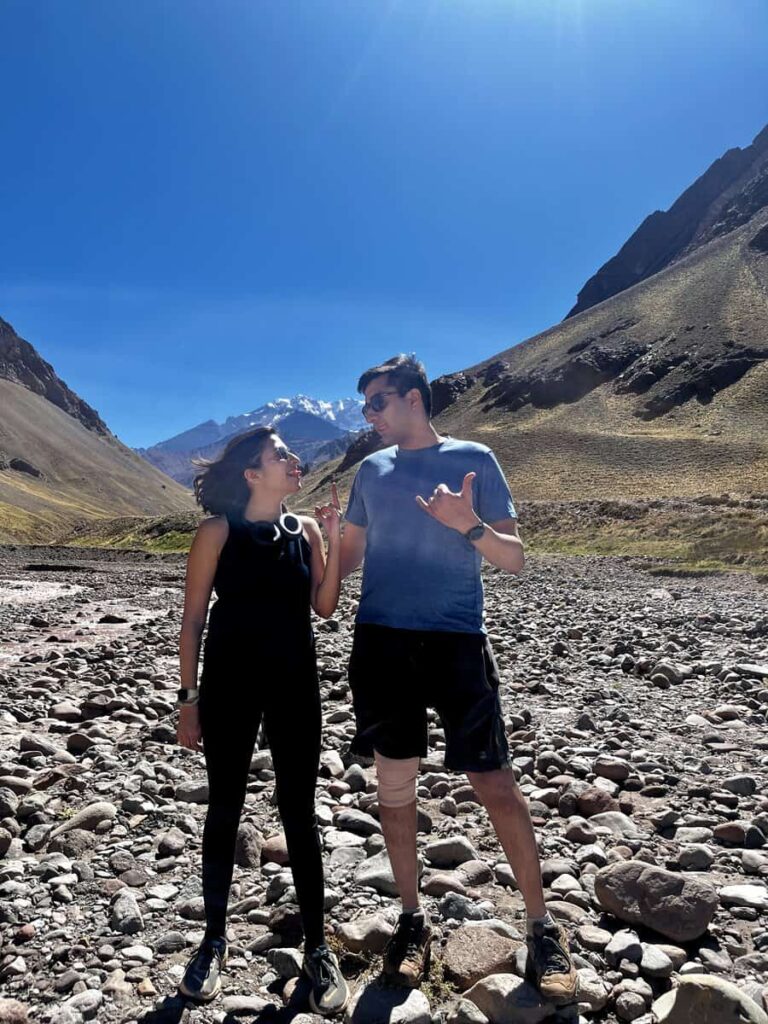
You reach it less than halfway in, just after crossing a glacial stream — and in my opinion, it’s the best view of Aconcagua you’ll get on the entire trail. From here, the mountain is fully framed, unobstructed by side ridges. You can see its sheer face, the slopes leading up, and the scale of the surrounding valley all at once. It’s dramatic, cinematic — and it’s also where most of the people are. Families, older hikers, folks turning around here. If you want a short version of the hike, this is the spot.
Beyond the bridge, the crowds thin and the trail begins to climb more steadily. You lose the direct line of sight to Aconcagua, but gain views of the lesser-known giants — including a nearby 5,000-meter volcano and a series of jagged ridges that look carved from shale. You feel more in the mountains, less like you’re observing from a distance.
We reached Confluencia Base Camp in just under two hours. It’s a functional place: yellow expedition tents, a ranger station, a few signs, not much else. But there were fewer people, more stillness, and a real sense of arrival. We parked ourselves in the sun, pulled out a bottle of wine and some hot dogs we’d brought from Mendoza, and ate lunch with the kind of views that make you forget your legs are tired.The return was faster — maybe 90 minutes, downhill and full of familiar views now in reverse. The best part? You can still see the bridge on the way back, and Aconcagua catches the afternoon light differently. One last reminder of how close you got.
What to Pack
This is a day hike, not an expedition — but you’re still heading to 3,400 meters in the Andes. What you bring can make or break your day.
⛺️ I’ve put together my full backpacking gear list here if you want to see everything I carry. You can also browse it all in my Amazon storefront.
Optional Detours
If you’ve got extra time (or energy), Aconcagua Provincial Park has more to offer beyond Confluencia.
Hike to the Suspension Bridge Only
Not everyone wants to hike 14 kilometers at altitude. The suspension bridge — less than halfway to Confluencia — offers the best view of Aconcagua and is a popular turnaround point for families and casual hikers. You still get the valley experience, minus the full-day commitment.
Trek to Plaza Francia (3-Day)
For a more immersive experience, the multi-day hike to Plaza Francia takes you to the foot of Aconcagua’s south face — the sheer, icy wall that climbers dream about. It’s a bigger undertaking but still non-technical if you’re prepared for alpine camping.
Tips for the Confluencia Hike
Where to Stay
Uspallata
We based ourselves in Uspallata, about 90 minutes from the park entrance. It’s quiet, surrounded by desert peaks, and puts you close enough for an early start without rushing. We stayed at Inca Roca — simple, cozy, and restful.
Mendoza
If you don’t mind a longer drive, Mendoza is the main hub, about 3 hours away. It’s packed with restaurants, wine bars, and hotels for every budget. You can absolutely do the hike as a day trip from here — just plan to be on the road by 5 a.m. if you want a decent hiking window.
After the hike, we headed straight back to Mendoza — a 3-hour drive that felt longer with tired legs and wine-sleepy eyes. If you’d rather stay city-side and do Confluencia as a day trip, it’s doable, but it makes for an early start. Mendoza has every kind of accommodation, from party hostels to boutique wine hotels.
Potrerillos
If you want a middle ground, Potrerillos sits halfway between Mendoza and Uspallata. Lakeside views, cooler air, and a more relaxed pace make it a solid base — especially if you’re not into mountain mornings.
Final Thoughts
You don’t need to summit Aconcagua to experience the scale of the Andes.
The hike to Confluencia is accessible, awe-inspiring, and logistically simple — once you get past the weird permit process. Whether you’re acclimating for a bigger trek or just want one unforgettable day in the mountains, this trail delivers. Big views, big air, no crampons required.